Forty hours that glide
From 24 hours back to 16 hours ahead, with motion interpolated playback so storms move instead of jump. New frames about every two minutes, plus single site velocity.
 Weather Map
Open the app
Radar that moves like it does on TV, from 24 hours back to 16 hours ahead. Hurricanes, lightning and three forecast models side by side, plus aviation weather for pilots. On the web, iPhone and your TV.
Every number tells you *where* *it* *came* *from* and *how* *old* *it* *is.* Most weather apps never do.
From 24 hours back to 16 hours ahead, with motion interpolated playback so storms move instead of jump. New frames about every two minutes, plus single site velocity.
Radar storm tracks flagged for hail and rotation, GOES lightning, SPC storm reports and every NWS warning polygon, all tappable.
NHC cone, track, warnings, wind field, surge and wind odds, with spaghetti models refreshed every 30 minutes.
The European, American and German models side by side for 10 days, with the days they disagree on flagged in yellow, so you know when to be careful.
About 5,200 METAR stations and 3,100 TAFs worldwide, updated every 10 minutes and drawn on the same map as the radar. Tap one for the decoded report, the raw text and the TAF, with Zulu and local times and how old it is.
Layers → Weather → Aviation → Airport weather
Layers → Weather → Aviation → Pilot cards
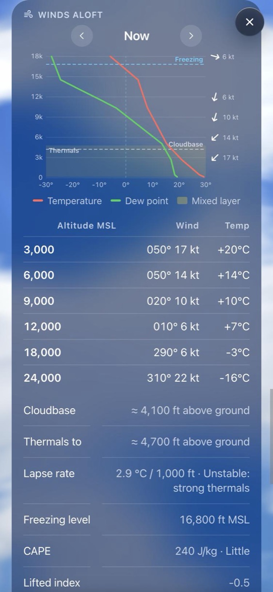
Step an hour at a time through 48 hours. A sounding chart to 18,000 ft shows temperature, dew point, the mixed layer, cloudbase and the freezing line, with winds and temperatures at 3,000 to 24,000 ft. Plus cloudbase, thermals to, lapse rate, freezing level, CAPE, lifted index and CIN.
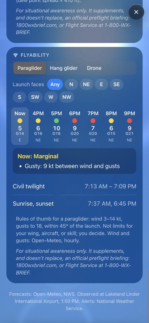
Pick paraglider, hang glider or drone, and which way your launch faces. The next 12 hours show as green, yellow or red, and tapping an hour lists every reason. Rules of thumb with the reasons shown, never a bare score. You decide.
Wind at 400 ft, cloudbase, visibility and the Kp index for GPS, checked against Part 107's 3 statute miles of visibility and 500 ft below clouds.
Icing, turbulence, IFR, mountain obscuration, wind shear and convective areas, colored by hazard. Tap for severity, base and top, and valid times.
PIREPs colored by the worse of turbulence and icing, with urgent reports ringed in red. Tap for altitude, aircraft and the report as filed.
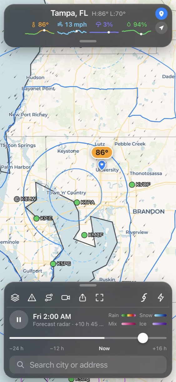
FAA temporary flight restrictions linked to their NOTAM pages, plus Class B, C and D airspace with every shelf's ceiling and floor.
The last good forecast, airport weather, advisories, winds aloft and airspace stay on your device, labelled with when they were saved.
For situational awareness only. It supplements, and doesn’t replace, an official preflight briefing: 1800wxbrief.com, or Flight Service at 1-800-WX-BRIEF. Pilot detail is off by default, so the app stays simple for everyone else.
Fifteen minute rain steps tell you when it starts or stops at your location.
Plan a route and see what you will meet, hour by hour, with traffic and DOT cameras.
A weather banner made for the big screen, already running on Fire TV.
Turn any radar loop into a video and send it to the group chat.
Wind, gusts, waves, sea temperature, wildfire smoke, air quality, aurora and more.
Wildfire perimeters, river gauges by flood category and NOAA tides, one tap away.
Open it in your browser now. On iPhone, tap Share and then Add to Home Screen and it opens like an app.